IMPORTANT FACTS ABOUT CHIAPAS
Chiapas was admitted as a state in 1824. With an area of 28,297 square miles, it is Mexico’s tenth largest state in terms of land. With its population of 4,895,919, it is the nation’s seventh most populous state. Historically, the main indigenous peoples to populate the region have been the Mayans, Mixes-Zoques, and Chiapa. Other major peoples that make their home in the state include the Tojolabals, Lacandons, Mochos, and Mams. In recent decades, the state has also witnessed an influx of refugees from countries such as Guatemala.
GEOGRAPHY OF CHIAPAS
Chiapas presents a unique environment; though it is within the tropical belt, it has a high altitude that affects the climate. The hot and humid regions are complemented by temperate and foggy regions of the central mountain ranges; these regions are famous for their cloud forests. The varied topography of Chiapas makes it one of Mexico’s most extraordinary landscapes. Its regional highlights include coastal plains, mountain ranges, and valleys. The forests and jungles of Chiapas are home to an amazing array of flora and fauna. Dazzling populations of quetzals are only one example of the exotic species of the region. In fact, areas of Chiapas have more diversity of animal life than anywhere in the Americas. Iguanas, jaguars, wild boar, bats, pelicans, armadillos, crocodiles, bobcats, ocelots, snakes, and many, many more species of wildlife thrive in Chiapas. The rain forests of the state are home to species of flora that exist nowhere else on the planet and several areas are protected within parks and reserves that lure visitors from around the world.
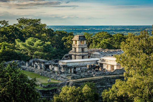
According to archaeologists, the area of Chiapas was first visited by hunter-gatherer peoples around 7000 B.C. Hunter gathering remained a popular way of life even as villages began to appear throughout the region by 300 A.D. This is also the time when Mayans began to dominate the region. While most of the Mayan cities collapsed around 900 A.D., their magnificent ruins at places like Palenque and Bonampak attest to their once grandeur. While the Aztec appeared in the region by the fifteenth century, they could not subjugate the regional tribes like the Chiapa. Nevertheless, the Spanish arrived during the sixteenth century and found the region largely divided between Mayan and non-Mayan groups. Although the rugged terrain prevented quick subjugation by the Spanish, they were able to find their first territorial city, San Cristobal, in 1528.
From the Spanish Colonial period to well into recent years, there have been many tumultuous uprisings over politics and labor disputes—the most recent was the Zapatista uprising where guerrilla forces temporarily occupied cities such as San Cristobal. Today, Chiapas remains largely isolated from the rest of the country due to its terrain and this isolation allows many of the state’s indigenous groups to retain their traditional way of life. Rich in culture and landscape, Chiapas is, nevertheless, Mexico’s poorest state.
TOURISM IN CHIAPAS
While the breathtaking landscape lures many travelers, still more visit Chiapas for its rich cultural traditions, handcrafts, and colonial architecture. Like many other states, Chiapas has designed three essential routes that tourists follow: the Coffee Route, the Colonial Route, and the Maya Route. The Maya Route is known for its splendid ecological sites and ruins. The Colonial Route features visits to various cities and towns in the Central Highlands that demonstrate important architecture—monasteries, churches, and public buildings dominate this route. The Coffee Route, not surprisingly, is named for coffee production; haciendas and coffee plantations are popular among visitors, but the route is equally famous for its adventuresome activities and eco-tours.
OTHER THINGS TO SEE AND DO IN CHIAPAS
- Tuxtla Gutierrez: The state’s most modern city, the capital boasts many cultural attractions such as the Museo Regional de Antropologia e Historia, San Marcos Cathedral, and a major zoo known as El Zapotal Ecological Reserve.
- Palenque: These seventh-century Mayan ruins are located near the Usumacinta River; although the site is considered mid-sized in terms of other discovered Mayan cities, it is said to have much of the finest architecture and carvings ever produced by the Mayans.
- San Cristobal de las Casas: Located in the central highland region of the state, San Cristobal is home to many historic landmarks and buildings that date from the Spanish Colonial era.
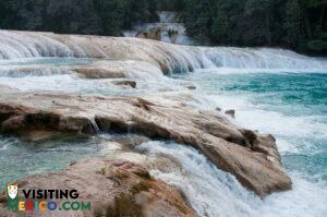
- Agua Azul Waterfalls: These picturesque blue waterfalls are located near the site of Palenque and are revered as some of the state’s most enchanting scenery.
- Yaxchilan: This city was founded by the Mayans near the Usumacinta River and is noted for its ruins that feature ancient hieroglyphics.
- Sumidero Canyon: Surrounded by a national park, Sumidero Canyon is north of the capital city and one of the most popular tourist attractions of the state. Flow from the Grijalva River and other smaller rivers into the canyon makes for areas of rapids, beaches, and waterfalls.
- Tacano Volcano: Situated on the border with Guatemala, this peak last erupted in 1986, but it continues to attract climbers. It has been declared a UNESCO World Biosphere Reserve.
- Laguna Miramar: Also located on the Guatemalan border, this pristine jungle region is noted for its entrancing blue lake and Mayan ruins.
Plan a trip to Chiapas
Restaurant • Bar • Free WiFi • etc

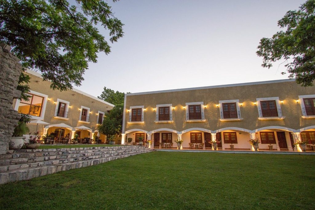
Room Service • Restaurant • ATM Machine • etc


