

Chihuahua Map Download
Download the Chihuahua map and plan your drive from El Paso, Ciudad Juárez, Mexico 45D, Chihuahua City, Copper Canyon routes, and northern Mexico road trip corridors.
Chihuahua is one of Mexico’s largest and most road-trip-friendly states, with border routes, desert highways, mountain roads, Copper Canyon connections, and important corridors between El Paso, Ciudad Juárez, Chihuahua City, and central Mexico.
The original map page focused on driving from El Paso through the Zaragoza / International Bridge area and continuing south toward Chihuahua City via Mexico 45 and 45D.
Free Map Delivery
Use the Chihuahua map to plan border routes, toll roads, city access, Copper Canyon connections, and long-distance driving across northern Mexico.
✓ Email Me the Chihuahua Map ✓ Open the Chihuahua Travel Guide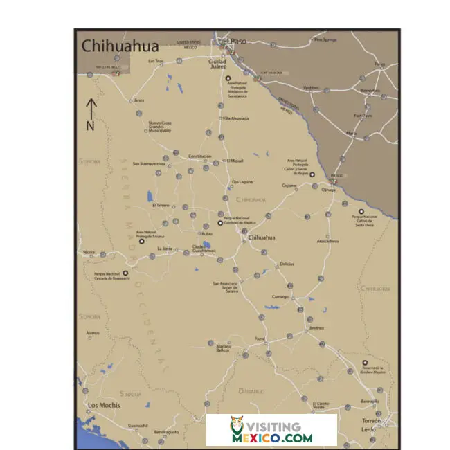
Use this map to orient yourself before driving through Chihuahua. It is especially helpful for travelers connecting from El Paso, Ciudad Juárez, Chihuahua City, Copper Canyon, Los Mochis, Torreón, and other northern routes.
The classic driving route from El Paso generally crosses into Ciudad Juárez, then continues south toward Chihuahua City using Mexico 45 / 45D. Exact lanes, ramps, and border procedures can change, so use live navigation along with your downloaded map.
The original route describes using the TX-375 Loop East area and the Zaragoza / International Bridge corridor before entering Mexico.
After crossing, travelers continue through Ciudad Juárez and connect toward Chihuahua / Miguel Ahumada / Panamericana / Mexico 45.
Mexico 45D is a toll road corridor toward Chihuahua City. Carry pesos and keep toll receipts during your drive.
Read toll road tips →Chihuahua City can be busy and confusing for first-time drivers. Download the map before arrival and save your hotel address offline.
The state capital is a useful stop for hotels, restaurants, supplies, services, and routes deeper into the state.
Explore Chihuahua →Many Chihuahua road trips connect toward Copper Canyon, Creel, mountain towns, and El Chepe train routes.
Explore Copper Canyon →Chihuahua routes can involve long distances. Refuel early, carry pesos, and avoid running low in remote areas.
Read fuel tips →Check current route conditions and safety advisories before driving, especially on remote or unfamiliar routes.
Review safety advisory →Download the Chihuahua map, offline navigation, hotel address, insurance documents, and emergency numbers before you cross into Mexico. Cell coverage and data access can vary along long highway stretches.
Driving to Chihuahua?
Before driving into Chihuahua, review border crossing documents, FMM rules, TIP requirements, toll roads, safety advisories, and Mexico insurance.
Yes. Use the map download button on this page to request the Chihuahua map by email.
Many travelers cross from El Paso into Ciudad Juárez, then connect south toward Chihuahua City using Mexico 45 / 45D.
Yes. Mexico 45D includes toll road sections. Carry pesos, keep receipts, and review toll road guidance before your trip.
Yes. Chihuahua City and the state of Chihuahua are important gateways for Copper Canyon, Creel, and El Chepe travel planning.
Yes. U.S. and Canadian liability insurance is not recognized by Mexican authorities for damage you cause in Mexico. At minimum, carry Liability Only coverage from a Mexican carrier. Learn more at GoBuho.com or get an instant quote at GoBuho.com.