Free Sonora Map · San Carlos & Guaymas

San Carlos Guaymas Map

Get the San Carlos and Guaymas map delivered to your inbox before you drive south. Use it to plan your Sea of Cortez arrival, preview the area, and keep key Sonora road trip resources close on your phone.

Instant email delivery Mobile-friendly travel resource Routes from Nogales, Sonoyta & Puerto Peñasco Border + RV links included
Built for travelers driving to San Carlos, Guaymas, the Sea of Cortez, and Sonora beach destinations.
Download the map before you lose signal, cross the border, or start the final drive. Enter your information once and get the San Carlos–Guaymas map sent directly to your email inbox.
Map Preview

Use the map to orient yourself before arriving in San Carlos or Guaymas.

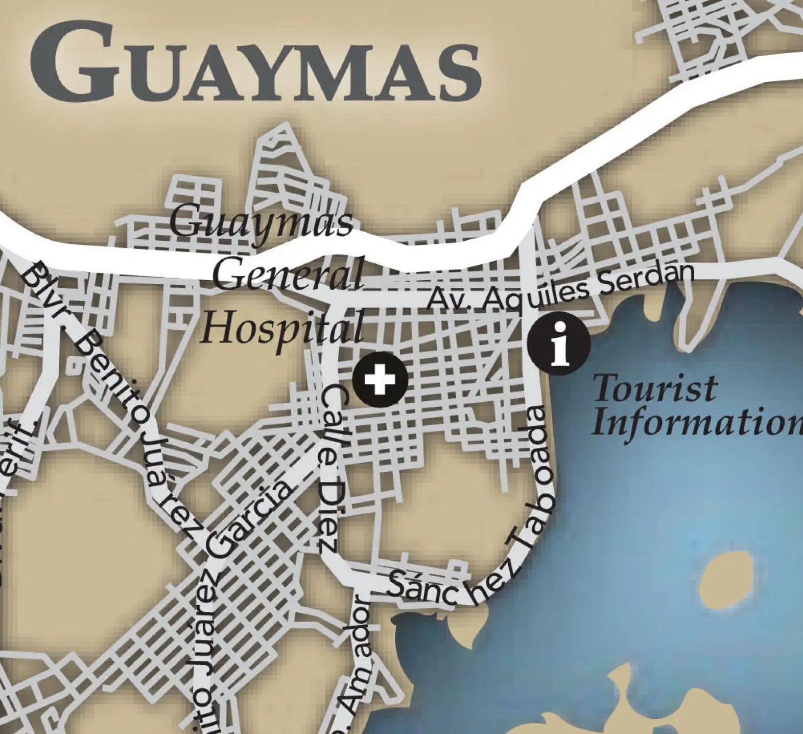
San Carlos and Guaymas are close together, but the area is easier to understand when you can see the relationship between the bay, beaches, marina, Guaymas, route access, and the surrounding Sonora coastline before you arrive.

This page is designed for travelers who are already planning the drive: snowbirds, RV travelers, beach visitors, families, expats, boaters, and anyone building a Sonora road trip around the Sea of Cortez.

San Carlos Guaymas map preview for Sonora Mexico travel planning
Map delivered by email Keep the map link handy on your phone before the Sonora drive.
Why Download It

A simple travel map for a high-value Sonora trip.

The goal is not just to look at a map once. It is to give yourself a practical planning resource before you choose your route, arrange insurance, check permits, and drive toward the coast.

1

Plan before departure

Review the San Carlos–Guaymas area before leaving Nogales, Sonoyta, Puerto Peñasco, Hermosillo, or another Sonora starting point.

2

Keep it on your phone

The map is intended for mobile trip planning, so you can keep the link in your inbox and return to it while planning your arrival.

3

Connect your travel resources

Pair the map with Mexico insurance, border crossing, FMM, vehicle permit, Free Zone, and RV resources before taking your vehicle south.

Driving Routes

Popular routes to San Carlos and Guaymas

The original map page highlights route guidance from three common Sonora approaches. Use these route previews as a planning aid, then confirm current conditions before driving.

Border Route

From Nogales

  • Use 15-D / 15-S toward Hermosillo and Guaymas.
  • Continue south through the main Sonora corridor.
  • Exit at Guaymas, then continue toward San Carlos as needed.
Northwest Sonora

From Sonoyta

  • Follow México 2 south from Sonoyta.
  • Connect toward Hermosillo and the 15-S corridor.
  • Continue south toward Guaymas and San Carlos.
Beach-to-Beach

From Puerto Peñasco

  • Choose between the SON 3 route or the 15-S / Hermosillo route.
  • Plan extra time for distance, fuel, road conditions, and rest stops.
  • Download the map before beginning the longer coastal-to-coastal drive.
Destination Context

Know where you are going before you arrive.

San Carlos is the beach, bay, marina, sunset, and RV-friendly side of the trip. Guaymas is the historic port city, with access to local services, harbor culture, cathedral views, seafood, and the larger urban center nearby.

Use the map as your planning bridge between both destinations, then use the full travel guide for hotels, restaurants, beaches, viewpoints, and things to do.

San Carlos Bay in Sonora Mexico
Sea of Cortez arrival planning Map first, destination guide second, insurance before you cross.
Get the Map

Send the San Carlos Guaymas map to your inbox.

Keep the map handy, plan your route, review border and permit resources, and get your Mexico insurance quote before driving south toward the Sea of Cortez.

FAQ

San Carlos Guaymas map questions

How do I get the San Carlos Guaymas map?

Click the “Instant Email Inbox Delivery” or “Send Me the Free Map” button on this page. A popup will open so you can enter your information and receive the map by email.

What is the San Carlos Guaymas map for?

The map is designed to help travelers understand the San Carlos and Guaymas area in Sonora, Mexico before arriving, especially when driving or planning a Sea of Cortez road trip.

Is this map useful for driving to San Carlos?

Yes. The map page is especially useful for travelers driving to San Carlos or Guaymas and planning their arrival from common Sonora routes.

What routes are covered on this page?

This page previews common routes from Nogales, Sonoyta, and Puerto Peñasco, including approaches that connect toward Mexico 15-S and the Guaymas area.

Can I use the map on my phone?

Yes. The map is intended to be delivered by email so you can keep it handy on your mobile device while planning your trip.

Should I download the map before crossing the border?

Yes. Downloading or saving the map before departure is recommended so you have it available before the drive, especially if you are still organizing route, permit, insurance, and border details.

Do I need Mexico insurance to drive to San Carlos or Guaymas?

Travelers driving their own vehicle in Mexico should arrange Mexico auto insurance before crossing. This page includes BUHO insurance quote and information links to help prepare for the drive.

Where can I learn more about San Carlos and Guaymas?

Visit the full San Carlos and Guaymas destination guide at https://visitingmexico.com/sonora/san-carlos-guaymas/ for beaches, hotels, restaurants, viewpoints, driving tips, and local travel resources.

Trip Planning Coahuila
Trip Planning Tamaulipas
Trip Planning San Miguel de Allende
Trip Planning Sinaloa
Trip Planning Morelia
Trip Planning Riviera Nayarit
Trip Planning San Cristobal de las Casas
Trip Planning Palenque
Trip Planning Monterrey
Trip Planning Nuevo Leon
VM Trip Planning Hermosillo
VM Trip Planning San Carlos
VM Trip Planning Puerto Peñasco
VM Trip Planning Sonora
VM Trip Planning Mexico City
VM Trip Planning Ciudad Juarez
VM Trip Planning Chihuahua
VM Trip Planning Los Cabos
VM Trip Planning Todos Santos
VM Trip Planning Loreto
VM Trip Planning Baja California Sur
VM Trip Planning Tijuana
VM Trip Planning Mexicali
VM Trip Planning Tecate
VM Trip Planning Puerto Nuevo
VM Trip Planning Valle de Guadalupe
Plan Your Visit to Ensenada
VM Trip Planning Rosarito
VM Trip Planning San Felipe
VM Trip Planning Baja California
B2B Conference Signup

51 - B2B Conference Signup

Form signup from a conference to retrieve business details of people in Mexico who have business that would like to be affiliated with our website for marketing and advertising purposes.

Location of the Business
Type of Business
Off Road Map

34 - Off Road Map

The Automobile options includes SUV, Pickup and Van but custom vans will fall into the RV option.
Free Zone Map

33 - Free Zone Map

Baja Surf Map

32 - Baja Surf Map

Automobile (Sedan, Pickup, SUV, even if towing an RV you select Automobile). RV should be selected for custom-vans.
Yucatan RV Guide

31 - Yucatan RV Guide

How will you get to Yucatan?
Campeche RV Guide

31 - Campeche RV Guide

How will you get to Campeche RV Guide?
Yucatan RV Guide

30 - Yucatan RV Guide

How will you get to Yucatan RV Guide?
Sonora RV Guide

29 - Sonora RV Guide

How will you get to Sonora RV Guide?
Sinaloa RV Guide

28 - Sinaloa RV Guide

How will you get to Sinaloa RV Guide?
Nayarit RV Parks

27 - Nayarit RV Parks

How will you get to Nayarit RV Parks?
Coastal Michoacan Guerrero RV Guide

26 - Coastal Michoacan Guerrero RV Guide

How will you get to Coastal Michoacan Guerrero RV Guide?
Coastal Jalisco Nayarit RV Guide

25 - Coastal Jalisco Nayarit RV Guide

How will you get to Coastal Jalisco Nayarit RV Guide?
Jalisco RV Parks

24 - Jalisco RV Parks

How will you get to Jalisco RV Parks?
Baja California RV Guide

23 - Baja California RV Guide

How will you get to Baja California RV Guide?
Tijuana

20 - Tijuana

Valle de Guadalupe

21 - Valle de Guadalupe

For Sedans, SUV, and Pickup Truck (with or without towed units attached) select Automobile. For Conversion Vans select "RV".
RV Guide Baja California Sur

22 - RV Guide Baja California Sur

How will you get to RV Guide Baja California Sur?
Tecate

19 - Tecate

Use RV for conversion vans. For pickups, SUV's and sedans use "automobile".
Tamaulipas

18 - Tamaulipas

For SUV, Pickup Truck, Sedan or Crossover with or without a towed unit attached select "Automobile". For van conversion, select "RV".
Sonora

17 - Sonora

For SUV, Pickup Truck, Sedan and Crossovers or Minivans, select "Automobile". For Van Conversions, select "RV"
San Felipe

16 - San Felipe

For Pickup Truck, SUV, Sedan or Minivan and crossover, select Automobile. For Van Conversions select RV.
San Carlos/Guaymas

15 - San Carlos/Guaymas

For pickup truck, sedan, cross-over or mini-van with or without a towed unit, select "Automobile". Conversion vans should select "RV".
Rosarito

14 - Rosarito

For SUV, Pickup Truck, Minivan and Crossovers select "Automobile". For Van Conversions use "RV".
Puerto Peñasco

13 - Puerto Peñasco

For SUV, Crossover, Pickup Truck or Sedan with or without a towed unit, select "Automobile". For a van conversion, select "RV".
Puerto Nuevo

12 - Puerto Nuevo

For Pickup Truck, SUV or Cross-over/Minivan select "Automobile" but for Van Conversions select "RV".
Monterrey

11 - Monterrey

For pickup truck, SUV/Crossover, sedan with or without towing select "Automobile". If you operate a conversion van in Mexico, select "RV".
Mexico City

10 - Mexico City

Mexicali

9 - Mexicali

For pickup truck, sedan, SUV or minivan select "Automobile" but for Self Propelled RV's or Conversion Vans - select RV. Dune Buggies shoud be "Motorcycle"
Juarez

8 - Juarez

For pickup truck, SUV or Crossover, select "Automobile". For van conversion, select "RV."
Jalisco

7 - Jalisco

How will you get to Jalisco?
Hermosillo

6 - Hermosillo

For pickup truck, sedan, SUV or crossover with or without a towed unit attached select "Automobile". For van conversions, select "RV".
Ensenada

5 - Ensenada

For sedan, pickup, suv with or without towed units select "automobile" but for a van conversion select "RV".
Chihuahua

4 - Chihuahua

Use Automobile for Pickup Truck and Towing Vehicles; Use RV for Custom Camper Vans and Self-Propelled RV's.
Baja California Sur

3 - Baja California Sur

For Sedan, SUV/Crossover, Pickup Truck select Automobile, for a conversion van select RV.
Ajijic

1 - Ajijic

"*" indicates required fields

For sedan, pickup truck, SUV or Crossover select "Automobile". For Conversion van select "RV"
Baja California Map

2 - Baja California Map

Use "Automobile" for Pickup truck, sedan, wagon, or SUV. Use "RV" for self-propelled RV units including custom vans.